Max Altitude Drone Services
For all your aerial imagery needs
Who we are
Max Altitude Drone Services is a North Carolina-based drone imagery company built on a foundation in precision agriculture and engineering. We don't just fly drones — we understand the data behind the images. Whether it's thermal patterns on a rooftop or plant populations across a field, we deliver imagery you can actually make decisions with.
Check out just a few of the services we offer
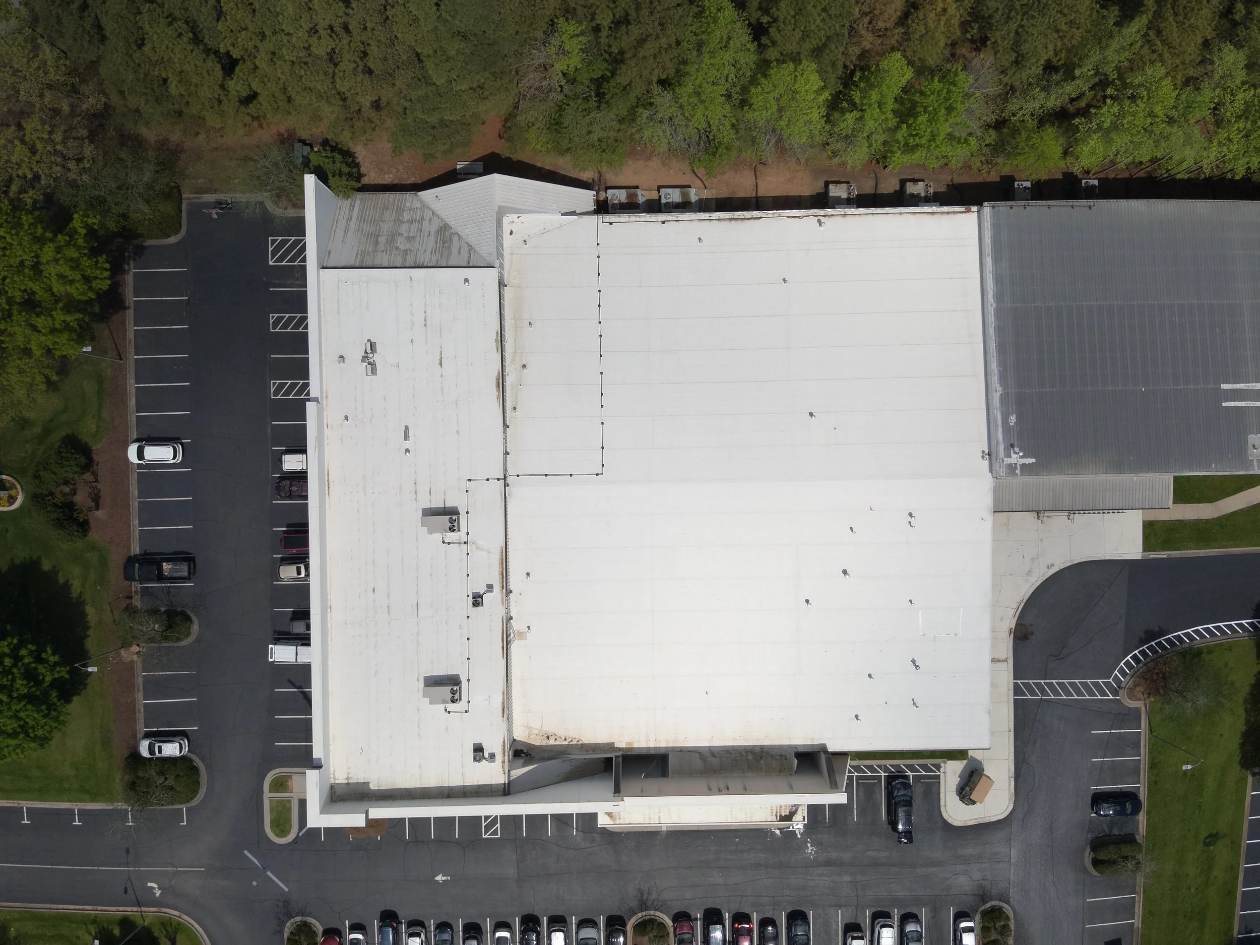
Building Inspection
Aerial imagery gives you a perspective on your property that's impossible from the ground. From roof assessments to general property documentation, our high-resolution and thermal-equipped drones capture the detail you need — whether it's for maintenance planning, insurance purposes, or showcasing your property.
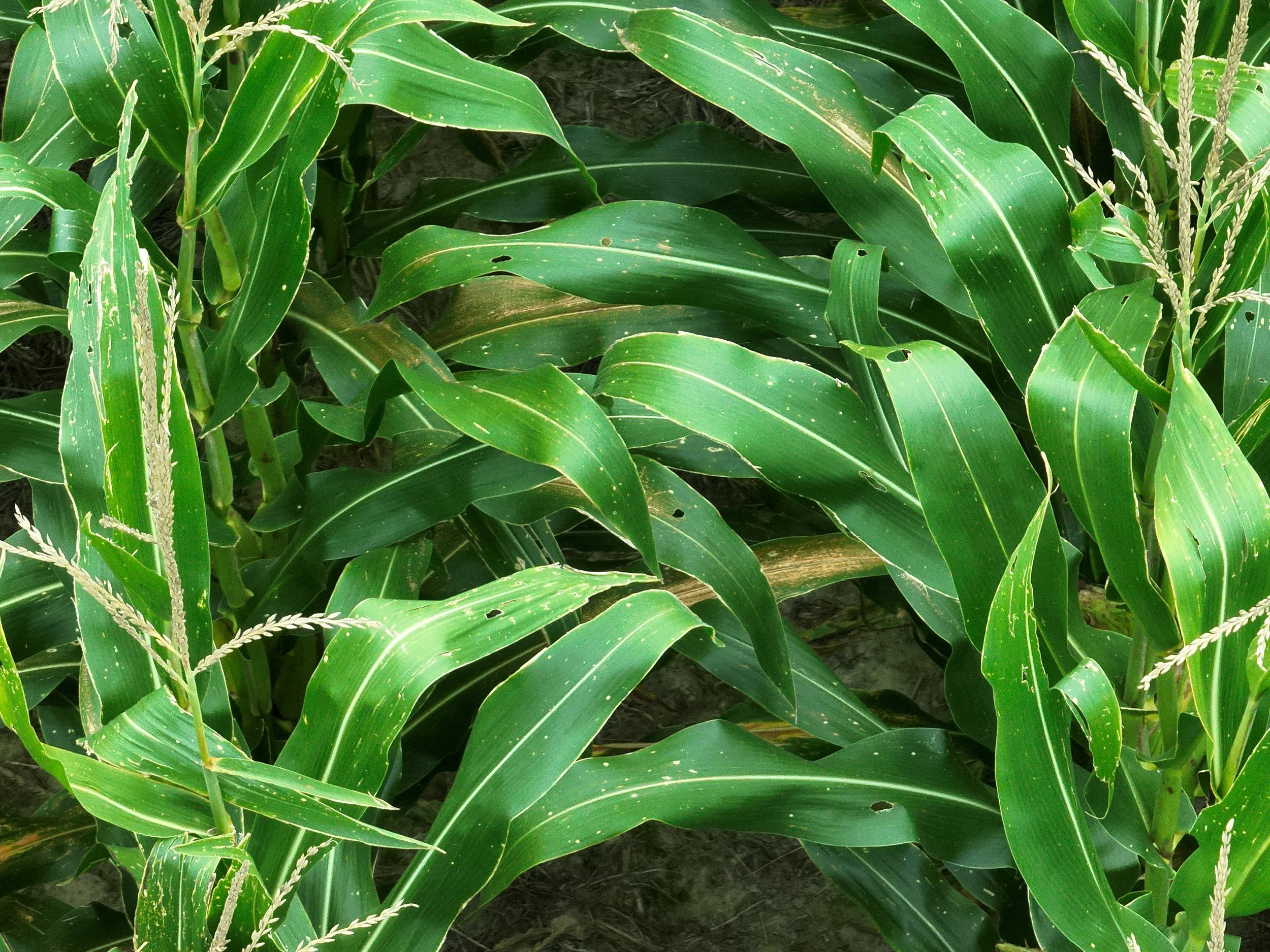
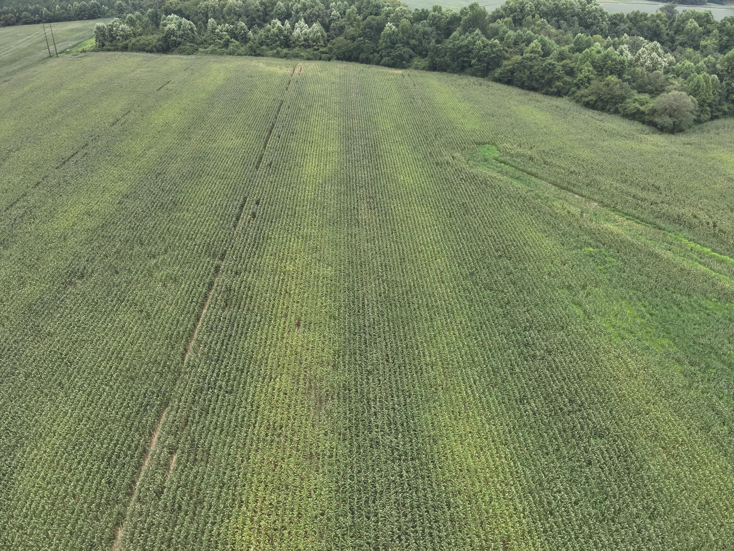
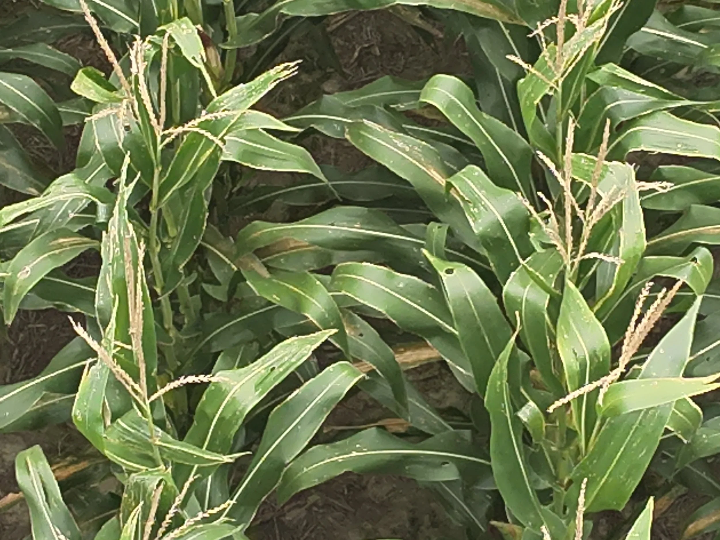
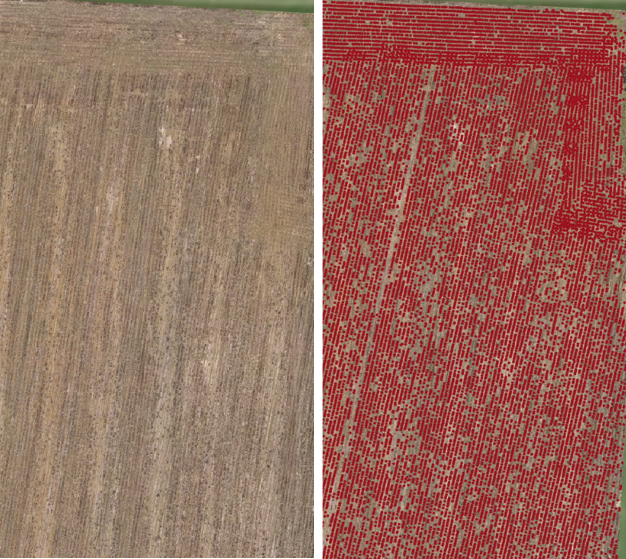
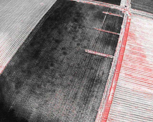
Crop Scouting
Get a clear picture of what's happening across your fields. Our drone imagery can help identify problem areas, assess storm or weather damage, and deliver accurate stand count data — giving you the information you need to make timely management decisions.

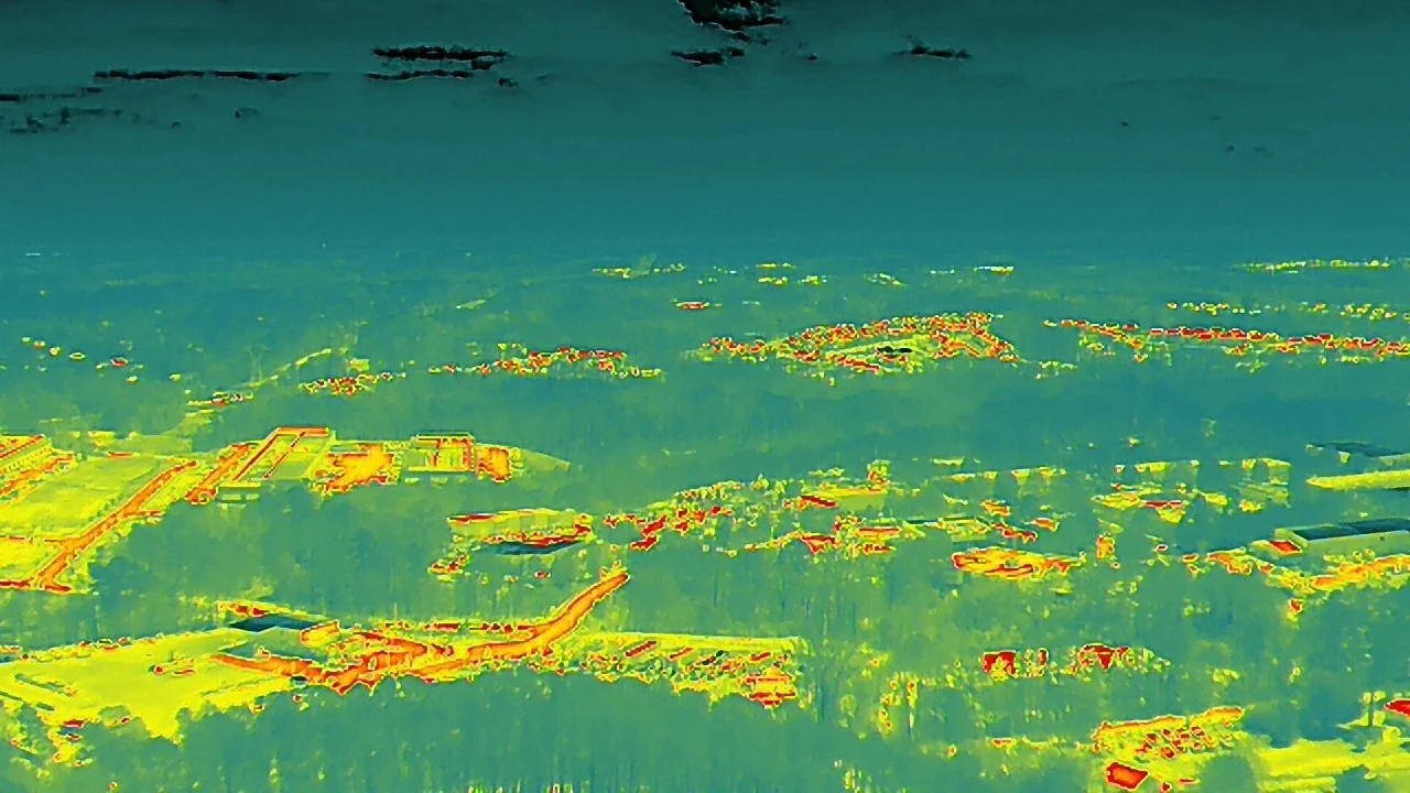
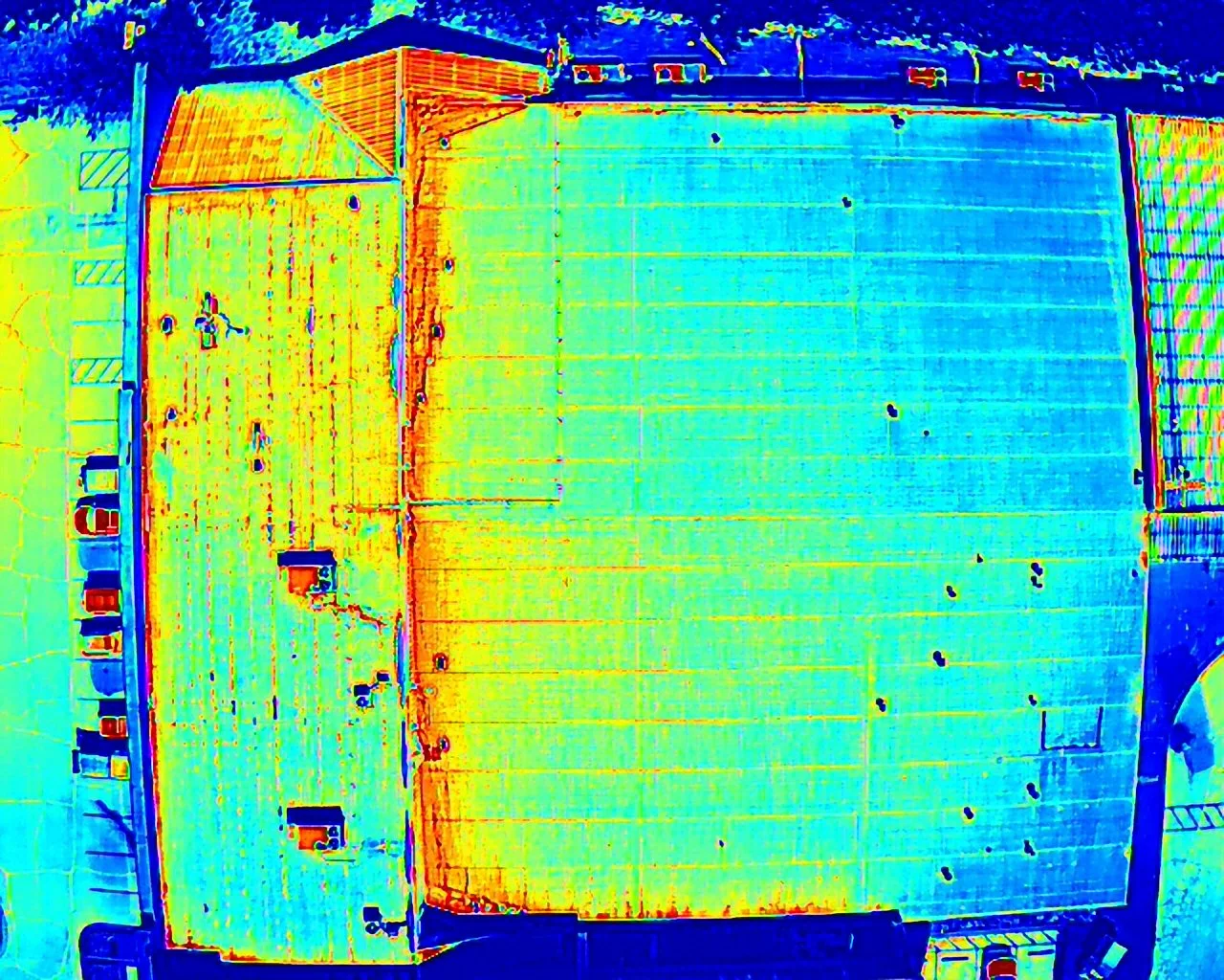
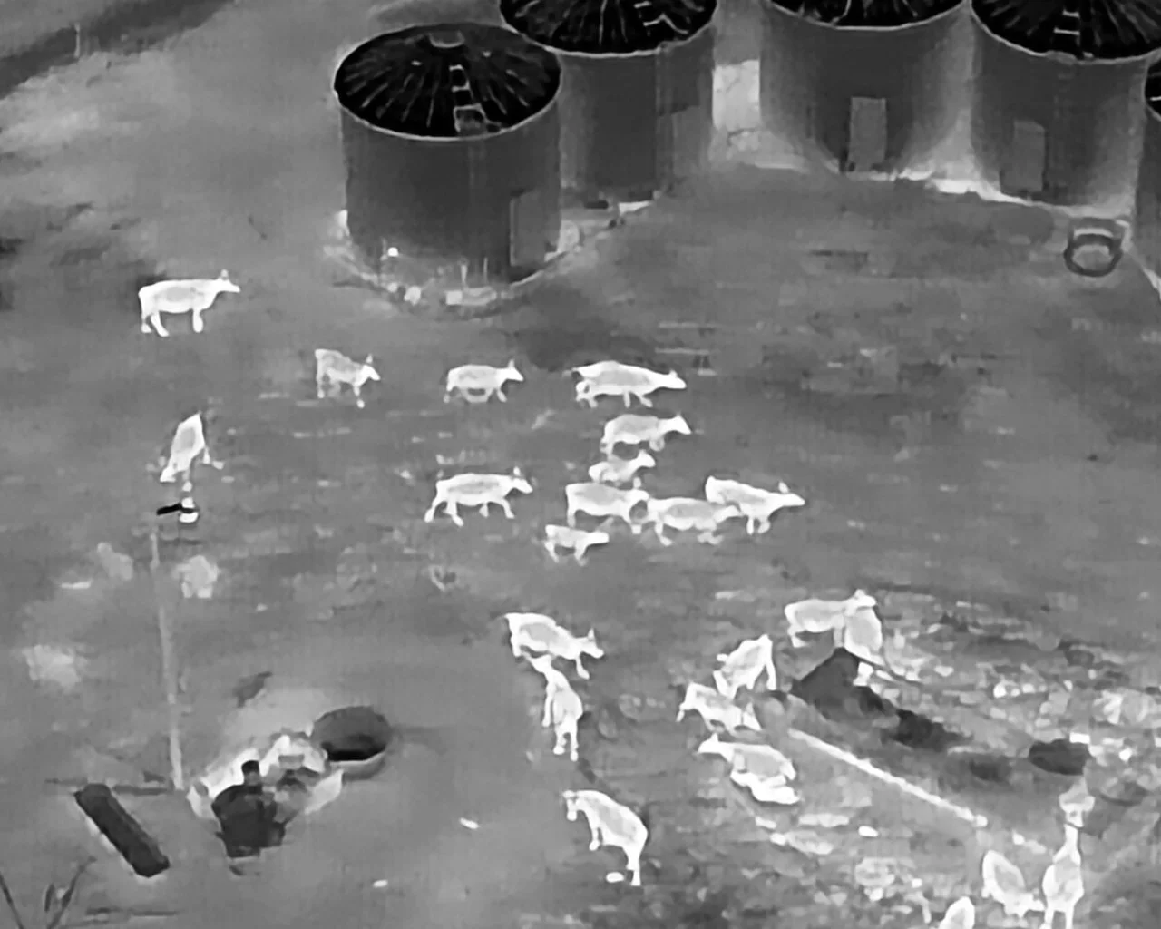
Thermal Imagery
Our drones are equipped with radiometric thermal cameras, adding another layer of insight to any inspection. Thermal imagery can reveal temperature differences that aren't visible to the naked eye — useful for evaluating building envelopes, locating livestock or wildlife, and assessing crop stress.
Video
What sets us apart
RTK Accuracy
Our drones are equipped with RTK antennas, allowing for centimeter level accuracy when performing flights that require high level precision
Flexible Scheduling
Our pilots are dedicated to working with your schedule to ensure we capture the best imagery to suit your needs
Post Processing
Let us do the work for you! We have access to some of the best software to convert aerial imagery into a useful data set for you, so you can feel confident about your future management decisions
About
Max Altitude Drone Services is owned and operated by Max Hooks, a North Carolina native with a background in precision agriculture and engineering. With experience in UAV-based multispectral imagery and data analysis, Max brings more to the table than just a drone — he brings an understanding of the data it produces.
Whether you're a farmer looking for actionable field data, a property owner needing a detailed inspection, or an attorney building a case that requires aerial documentation, Max Altitude Drone Services is equipped to deliver professional, reliable results.
All flights are conducted by FAA Part 107 certified pilots with authorization for both daytime and nighttime operations.